
We decided to start our first day on Hatteras Island with a visit to the lighthouse, which was only a couple miles north of our motel. We’ve become a bit fascinated with lighthouses ever since our trip to Florida in 2011, during which we saw the St. Augustine Lighthouse.
According to the National Park Service, which maintains the lighthouse and the keepers’ quarters, the Cape Hatteras Lighthouse protects one of the most hazardous sections of the Atlantic Coast. Offshore of Cape Hatteras, the Gulf Stream collides with the Virginia Drift, a branch of the Labrador Current from Canada. This current forces southbound ships into a dangerous twelve-mile long sandbar called Diamond Shoals. Hundreds and possibly thousands of shipwrecks in this area have given it the reputation as the “Graveyard of the Atlantic”.

This is a beautiful lighthouse, and one of the most famous and recognizable in the world.
Climbing to the top is allowed. If one is up to the challenge, for a fee of $8, one may climb the “257 steps from the ground to the watchroom, which is equal climbing a 12 story building. The stairs have a handrail only on one side and a landing every 31 steps. There is no air conditioning. It may be noisy, humid, hot and dim inside the lighthouse and there is two-way traffic on the narrow stairs.” Having the dogs with us, we declined. At least, that is our story and we are sticking to it.
The lighthouse has an interesting history. Constructed in 1802, it apparently did not live up to the task. According to Wikipedia, in July 1851, Lt. David D. Porter, USN, reported as follows:
“Hatteras light, the most important on our coast is, without doubt, the worst light in the world. Cape Hatteras is the point made by all vessels going to the south, and also coming from that direction; the current of the Gulf Stream runs so close to the outer point of the shoals that vessels double as close round the breakers as possible, to avoid its influence. The only guide they have is the light, to tell them when up with the shoals; but I have always had so little confidence in it, that I have been guided by the lead, without the use of which, in fact, no vessel should pass Hatteras. The first nine trips I made I never saw Hatteras light at all, though frequently passing in sight of the breakers, and when I did see it, I could not tell it from a steamer’s light, excepting that the steamer’s lights are much brighter. It has improved much latterly, but is still a wretched light. It is all important that Hatteras should be provided with a revolving light of great intensity, and that the light be raised 15 feet (4.6 m) higher than at present. Twenty-four steamship’s lights, of great brilliancy, pass this point in one month, nearly at the rate of one every night (they all pass at night) and it can be seen how easily a vessel may be deceived by taking a steamer’s light for a light on shore.”
Improvements were made, but in the end, at the behest of mariners and officers of the U.S. Navy, Congress appropriated $80,000 to construct a new beacon at Cape Hatteras in 1868.
Being a barrier island, Hatteras is really just a big sand bar, subject to shifting and constant erosion. Due to this erosion, the lighthouse was actually moved from its original location at the edge of the ocean to safer ground 2,870 feet (870 m) inland. Prior to the move, the lighthouse was just 120 feet from the ocean’s edge and was in imminent danger. (Later in the week, we met a woman who told us more about the moving of the lighthouse from her firsthand perspective.)
While the above information was taken from Wikipedia, we had the good fortune to hear a talk from one of the Park Rangers while we were there. He described the shifting sand and erosion with the use of visual aids such as geological graphs and actual sand.
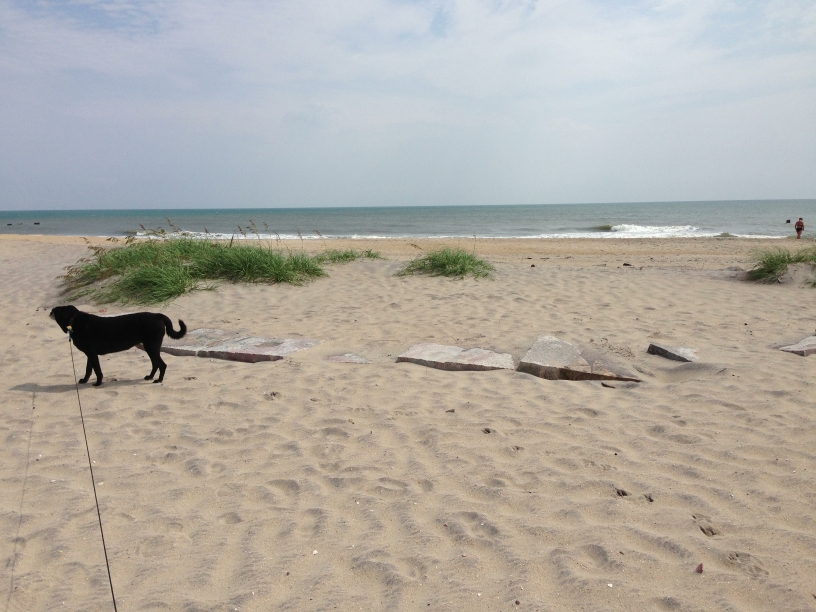
We walked to the beach area near the lighthouse and found the stones which mark the site where the lighthouse was previously located:
During our explorations later in the day, we quickly saw that sand dunes are one of the prominent features of the Outer Banks. There is really just one main road that runs the length of the Outer Banks, with a few side streets here and there. Much of our driving during the week looked like this:
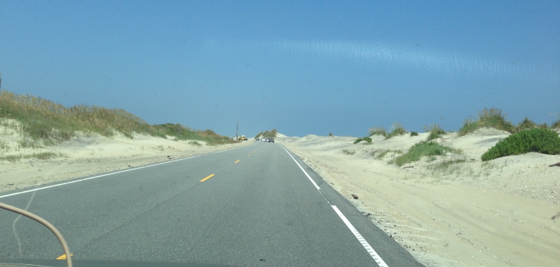
The Atlantic Ocean to the east and the Pamlico Sound to the west, the road just a tiny strip down the middle, connecting the small villages that dot the island.
More to come, including a visit to the Wright Brothers National Memorial.
